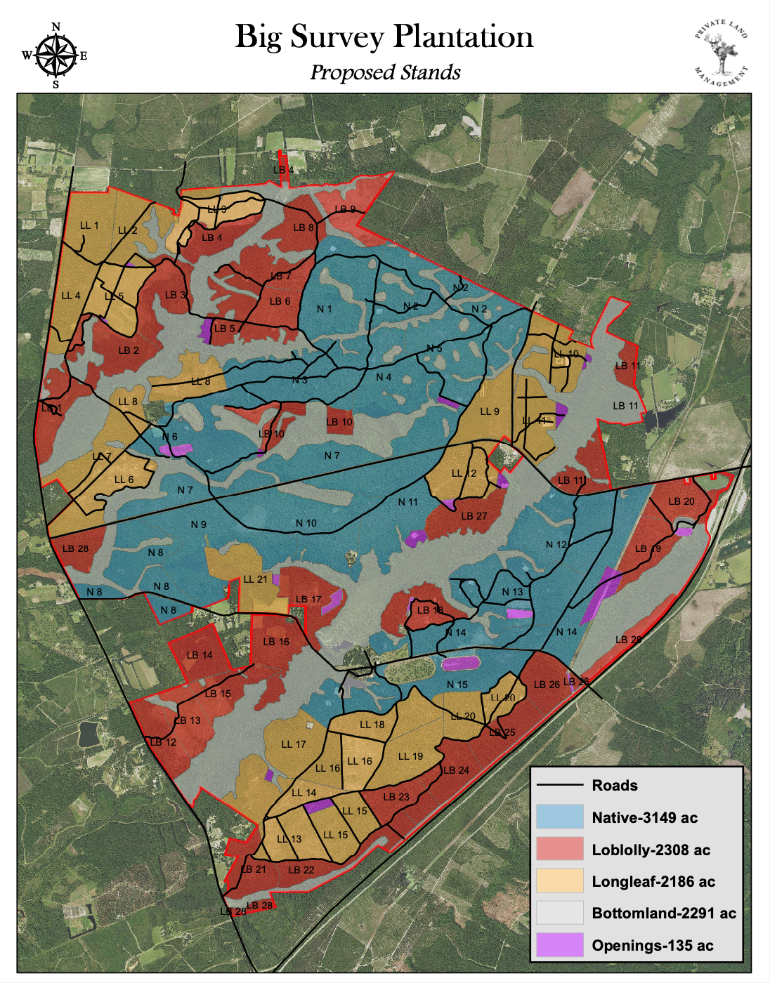
I work directly with you to design maps and layers to suit your needs.
An example of a custom hunt layer could be derived from the following criteria:
- Only areas atleast 2 miles and no more than 4 miles from roads/trails
- Only areas with a southern aspect
- Only areas less than 5k feet elevation
- Only areas within an elk's winter range in Montana
- Only areas in General Hunt Units in Montana
- Only areas on public land
This analysis would greatly minimize the available area and help you hone in on specific spots.
I also create custom property maps for wildlife/forest management and real estate listings.